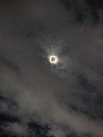
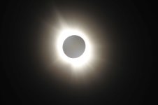
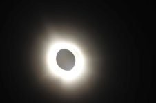
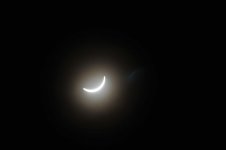
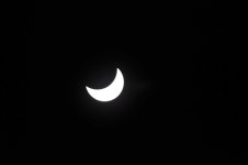
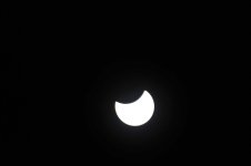
Total Eclipse of the sun

Jack, that is what I thought... But sitting in the hangar playing with it, I was able to scroll all the way out to 200, Doing some further research, where it will scroll out further, it will only show traffic up to 24 NM! Even with that, that too me seems to be well more than ample notice, and I think in a congested area it would show everyone on top of each other... It appears it will zoom all the way in to 2 Miles after playing with the Demo! Once I do it live, I will know more! As mention many times over the past number of months, I am still waiting on the plane, but it is now very close to being completed... (even though I am not holding my breath)
 
It depends on your data source. Sitting in a hangar it is very unlikely your ADS-B IN data is coming from ATC's rebroadcast. If the data in coming in via a wifi internet connection to either the hangar or your phone, then the software will know you're on the ground and act differently. Check the software spec to find out how it works.
 
I was just reading up on... It will show up to 24 Miles out from my GPS Location, however it will scroll out to 200 when it is also showing Weather! and the ADSB will just be in the center!
 
My foreflight will show traffic about 100 miles out if I turn off, "hide distance". It's a function of adsb not your receiver. That's with a Stratux
 
John, check your display software specs. Most GA, in-flight software only shows you the traffic within a 15 mile radius of your position.
I've had mine since Jan. 2015. So lots of experience with it. I leave the range on the display set to 5 mile radius because I don't need to see anything further away and I really don't like the screen cluttered up with 20 to 50 little moving symbols all headed away from me. What I care about is what is headed towards me, within 1000 feet of my altitude and close enough to (maybe) see them when I look out the window. The relative position info ADS-B IN gives me help me know where to look.
In fact with all your new gizmos you will find that after you've got about 10 hours flying with them you'll have found the display settings you like best and will leave them there.
I would open it up a bit more than 1000 feet up and down. A business jet or turboprop can be climbing or descending at a pretty good clip. 1000 feet might be less then 20 seconds. I'm not sure if rapidly changing altitude targets break-through the display limitations?
 
Good point... The a/c is still in work, but it should be ready soon... I know they have taken outside, but then found the Fuel Selector Leaking (Probably sat too long with Dry Tanks). Either way, it should not be too long off.
 
You can tell the bizjets and the military because their pointers are LONG compared to most GA. (The length of the pointer indicates where the target will in 1 minute if they maintain course and speed.) Anyone with a pointer the same length as my own ain't going to catch me by climbing.
The ADS-B rules laid down by the FAA require targets to change color as they close both distance and altitude. If within 5 miles horizontal they turn Yellow if they are within +/-1000' vertical of you, Red if it's +/- 500'.
FlyQ allows you to turn off traffic more then 15 miles away and more then 3000' above or below you, but everything else about the display is fixed by those ADS-B rules. Other display devices do as well from what I've read.

I've had pairs of Whibey NAS F-18's use me for target practice too many times to count. They have VERY LONG pointers on their icons. Usually they turn off and go back to whatever they were doing as soon as I make a 90 degree turn away from them. At that point they know they've been detected and that I don't want to play.
They did that around here a number of years ago. The jet jock was head down during the intercept and hardly felt it when his jet sliced the tail off of the GA aircraft.
 
Meanwhile back on the topic of the eclipse, anyone in the KXNA area? I'm going to be just east of there in the path, wondering if anyone's near in case of a get together...
 
I have some pics that I took as well.. Went down to Cape Girardeau (Drove Down) and got some pretty good pics... Been a long day. Plan to post some tomorrow! Tried to do a video of the transition, but I do not think it did too well.
 
There was enough on the TV and Internet to make me happy, so I just watched it and watch some of the press coverage. Got plenty of photos and videos off the Internet.
 
I had planned to takeoff from Huntsville and fly to Cape Girardeau for the Eclipse in the morning. waited for one storm to pass and then got ready to leave, but there was a ground stop over all of Memphis center. They would not issue any IFR clearances at all. A lot of people were stuck on the ground at Huntsville couldn’t get out, eventually I had to just ask for a VFR for departure and pick my own way through the clouds. Had to climb up to 10,500 ft to get over, but it got clear once we got into Kentucky.
Looking at all the traffic on ADS-B and knowing where the clouds were picking through myself, I wonder how many people were just “sending it“ and cutting through a few seconds / broken layer on their own….

we got to CGI at 1:45, just 15 minutes to spare. I noticed it looked like Evening time when I parked, so I knew we were curing it close. By the time we parked the plane and got to the FBO, it got dark.
there is a really good BBQ restaurant on the field, so after the eclipse passed i got a good brisket sandwich with my family. Then flew out VFR again Memphis Center was overwhelmed and non-stop radio chatter. It was almost like Oshkosh.
 
Last edited:
Some were concerned about the $150 I paid for the privilege of landing at Poplar Bluff, MO airport to watch the total solar eclipse. I am here to tell you what i received for my money. We got 3 nights of camping on field. We used one of their airport courtesy cars for 3 days. They gave us free water bottles. Fuel was $4.75/gal. We did pay for tickets to a Jeff Foxworthy concert which was totally awesome. The only negative is that there was some sort of major wind on Sunday when we were in town that collapsed a corner of our tent bending the poles. Other tents were also collapsed. I used a filter for my camera to take pictures of the sun during the various stages of the eclipse. I got pictures with my cell phone as well as with my 35mm camera without filters during the totality part. I would post pictures, but cannot figure a way to post them here. I have done that on my personal Facebook page if you want to find that. The trip was well worth it. KPOF is a very nice airport.
 
It is easy to post pictures. When you go to upload your images (I use .JPG files personally), Simply click on the "Insert Image" Icon in the top area where you are typing. Click on it and then simply drag your pictures into the box.

1713555120350.png

Once they have uploaded, hit send... All there is to it.

And $4.75 in Missouri is a good price. I am surprised they did not price gouge you for fuel seeing the Eclipse being a money maker for many localities!

John
 

Similar threads

Back
Top