Anyone want to share a ride to BACFest?

dystevens

Level Cruise
I am hoping that we can use this thread for possible ride sharing for BACFest. I am planning on flying my Super to BACFest but my dear wife has opted out of this trip. As a result, I have a couple of empty seats. Right now my planned route is pretty much GPS direct KFLY-->KAFO-->OU9-->3S9-->KVUO. Please let me know if anyone would like to share the ride. We could meet at KFLY or anywhere in between.
 
Dave, As a flat lander I had to plug your route into fore flight. What will be your planned altitude from KLFY and KAFO? Living in Colorado I am sure you know more about mountain flying than I do. This my planned route I75-KODX-CKW-kRKS-MLD-KBYI-BYI-KEUL-4S2-KVUO. What do you think? Highest altitude will be 12,000.
 
Denis, I have planned most of the route to KAFO at 12500 but I may have to either jump up to 13500 at one spot (depending upon clouds and weather) or deviate the route south a little to go through Kenosha pass and then follow the drainage between Breckenridge and Keystone. It doesn't take long to get to 13500 when you take off from 7000' ;). I plan on stopping for fuel at Afton, Wy (KAFO). Right now there are multiple firefighting TFRs in Oregon and Idaho. I hope they get these fires extinguished before the trip. It can sure reduce visibility :( even as far east as Colorado.
 
Last edited:
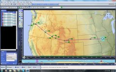
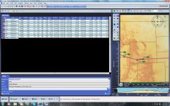
Denis, I plugged your route into Voyager. At first I thought you were taking the long way around but to my surprise it turned out to be only about 65 miles further than just going GPS direct to KVUO from I75. Voyager did show your route to take about 2 hrs longer the GPS direct route but this would all depend upon winds aloft on any given day. At 12000' you have ample clearance over any terrain you will encounter. In fact, at 12500' you would still have 1500' over anything you would encounter on the GPS direct route. One advantage to your southern route is that you wouldn't have to worry about possible thunder storms in the mountains in the late after noon. If I am going to fly through the mountains this time of year I like to be through them by 11:00 AM.
Route.jpgFlight Plan.jpg
 
Dave, Thanks for the review. Most of the route will be filed IFR at 10,000. I will only have to climb to 12,000 for one leg. The POH shows the B24R losing 5 Kts from 10K to 12k, so better to stay lower.
 
Always be careful flying towards high terrain and into a head wind. Expect strong downdrafts or deadly mountain waves on the leeward side of mountain ridges in this senario.
 
When flying in high terrain, altitude is your friend. Cross any ranges at a 45 deg angle and be ready to take immediate action. Have a plan. Understand that Vx and Vy are significantly less at altitude than at sea level. Rule of thumb for Vy is that it is reduced by 1 knot every 1000 ft Density Altitude above S.L. Vx not so much, but still less. Stall never changes! Learn your clouds and fly early in the day.
 
My 2 cents worth - If you take the scenic route down the Columbia River Gorge do not fly low ! There are power lines strung across the canyon. Some are a much as 1000' above the river level.
 
Last edited:
Wednesday I tried to fly from KMCK in southwest Nebraska to Davenport, IA in our Sierra. We were trying to get by storms and IFR conditions in eastern Iowa before they got any worse. It did not work. Thursday morning everything in western Iowa was IFR so we looked at various solutions. We waited until 2 p.m. to depart Tekama, NE and found a hole(Linda calls them "sucker holes") and went up through it. We crossed Iowa at 13,500 ft. above the clouds. We came down northwest of Davenport in VFR conditions. This trip gave me a real life experience as to what the Sierra's performance is at that altitude. It is very poor. To get to 13,500 we had vertical climb rates of 100 to 200 ft. per minute and ground speeds on the level of about 117 to 120 kts. I have charts coming for the Portland trip, but am having serious thoughts about the risks involved.
 
Mike, Check the route that I listed early in this thread. The highest elevation is 9,000, with most of the terrain through Wyoming at 7-8K. If the winds are low I may stay at 10k and not climb to 12 to cross that spot. If winds are greater than 1O knt I will climb to 12 and that will put me 3k above it. I plan on making it two days, one to KRKS, stay there and then cross the higher elevation early in the morning. KRKS is at 6765 but has a 10,000 ft runway.
 
MIke,
My Sierra's performance drops off drastically at 10,000 feet and 250 feet per minute sounds about right. POH says 400 at 8,000 and 165 at 12000, depending on weight and temperature.

Rick
 
Mike,

I have been to 17,900 ft. in my Sierra and didn't notice the poor climb performance you mention. That was before my overhaul when my cam was missing 36% off one lobe that was operating two cylinder intake valves. 12,500-13,500 is where I fly a lot. I've never had much problem getting up there I have found in warm weather climb is mostly limited by CHTs not airplane climb performance. I set best power mixture and climb at the lowest IAS that allows CHTs below 400 degs F. Up that high the air is cool, but it's still, CHTs are a concern. Remember to reduce your Vy by 1 kt for every 1000 ft above sea level if the CHTs allow you to do so. I don't see a lot of risks flying in mountainous terrain if the weather is VFR. Usually weather is localized and you can go around it. A weather brief will give you an idea if it's time to fly another day. Although, the mountains can generate some pretty good localized weather, it's almost always in the late afternoon and you can beat the build-ups by flying early. Stay VFR with an out and usually you will be OK. You may spend some time on the ground waiting out the weather, but there is little pucker factor in that.
 
Back
Top