bbyer
In the Magellanic Clouds
Not CYEG, Edmonton International or Calgary International, CYYC
From Montana into Alberta, you could stop at Coutts/Ross International (CEP4)
https://en.wikipedia.org/wiki/Coutts/Ross_International_Airport
Coutts is 2900 turf, so for paved, Lethbridge, (CYQL), is probably preferable as they also have flush toilets etc.
https://en.wikipedia.org/wiki/Lethbridge_Airport
Saskatchewan and Manitoba are a bit easier in that almost no one lives in either Province but they still have some paved strips left over from the WWII Commonwealth Air Training Plan. For Saskatchewan, Regina, (CYQR) comes to mind.
For Manitoba, stay away from Brandon Manitoba, (CYBR), as the locals know all private aircraft owners are rich and charge a five hundred to a thousand dollar customs fee, (CanBuck, so you get a 30% discount). The excuse is 9/11; this is a bit unusual, but might I remind you, this is not the Land of the Free.
http://airport.brandon.ca/pilot/border-clearance
The following will work just fine to get you into Manitoba, as it is safely in North Dakota, (FAA S2 ), the International Peace Garden Airport, and is 3000 ft paved, has running water, and takes real money.
https://en.wikipedia.org/wiki/International_Peace_Garden_Airport
Josephburg is probably a good place for a night sleepover as well. As I said, five miles away are real hotels with running water, Heinz Ketchup and other delicacies of the South. You are also out of the CYEG control zone so that makes life a bit easier.
We do not have an ADS-B up here; a mode C transponder is the most you will need.
The Internet exists up here. The primary carriers are TELUS and BELL Canada, as well as Rodgers.
Telus is the best of the three re coverage as they are in British Columbia as well - they do the bush better than any of the others.
You will have to check with your US carrier to see if they have any arrangements re up here. I use TELUS as they have a "protection" shakedown fee I can buy for a hundred dollars a month that will keep me out of trouble in the States or Europe re roaming charges.
A Sat phone is not out of place and some sort of SPOT locator that talks to satellites might be a good idea. VHF coverage is not exactly guaranteed where you are passing over.
This link talks a bit about cell phone coverage and then goes on to discuss the best Sat phone.
https://www.gettingstamped.com/driving-to-alaska/
The one thing Canadian Customs will look for or ask about is guns. Big, little, old, survival, etc - as a rule, they are not at all reasonable, and they are deaf to "just passing thru", so you might want to do some research on that matter if it is applicable.
Once thru the fusses, what you will enjoy is hours of flying with only a little bit of traffic on 126.7 and watching the contrails at FL400 leading you to Elmendorf.
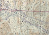
My thoughts are that you want to clear customs at a small airport. The link below provides a list of aircraft Ports of Entry. These have both US and Canadian Customs and I suggest you choose a little one, but not all are paved.Bbyer has made an offer to meet up at his airport and I think that would be a great idea. I didn't realize he was that close to Edmonton. Due to the different flight paths to get to the ALCAN route, CFB6 would be an excellent place to meet to start the journey together. My International departure airport will be Williston ND (it might work for Allen too), and Nelson/Michael's would most likely be Cut Bank, MT. The Canadian arrival airport would be Edmonton to clear customs, then just a short hop to CFB6.
I am jumping into planning, but I have been thinking about this for a couple years. We can have a planning get together at BACFest. The great thing about BAC is we have members that have made the trip, Canadian members, and Alaskan members that have a lot knowledge to help make this a success.
From Montana into Alberta, you could stop at Coutts/Ross International (CEP4)
https://en.wikipedia.org/wiki/Coutts/Ross_International_Airport
Coutts is 2900 turf, so for paved, Lethbridge, (CYQL), is probably preferable as they also have flush toilets etc.
https://en.wikipedia.org/wiki/Lethbridge_Airport
Saskatchewan and Manitoba are a bit easier in that almost no one lives in either Province but they still have some paved strips left over from the WWII Commonwealth Air Training Plan. For Saskatchewan, Regina, (CYQR) comes to mind.
For Manitoba, stay away from Brandon Manitoba, (CYBR), as the locals know all private aircraft owners are rich and charge a five hundred to a thousand dollar customs fee, (CanBuck, so you get a 30% discount). The excuse is 9/11; this is a bit unusual, but might I remind you, this is not the Land of the Free.
http://airport.brandon.ca/pilot/border-clearance
The following will work just fine to get you into Manitoba, as it is safely in North Dakota, (FAA S2 ), the International Peace Garden Airport, and is 3000 ft paved, has running water, and takes real money.
https://en.wikipedia.org/wiki/International_Peace_Garden_Airport
Josephburg is probably a good place for a night sleepover as well. As I said, five miles away are real hotels with running water, Heinz Ketchup and other delicacies of the South. You are also out of the CYEG control zone so that makes life a bit easier.
We do not have an ADS-B up here; a mode C transponder is the most you will need.
The Internet exists up here. The primary carriers are TELUS and BELL Canada, as well as Rodgers.
Telus is the best of the three re coverage as they are in British Columbia as well - they do the bush better than any of the others.
You will have to check with your US carrier to see if they have any arrangements re up here. I use TELUS as they have a "protection" shakedown fee I can buy for a hundred dollars a month that will keep me out of trouble in the States or Europe re roaming charges.
A Sat phone is not out of place and some sort of SPOT locator that talks to satellites might be a good idea. VHF coverage is not exactly guaranteed where you are passing over.
This link talks a bit about cell phone coverage and then goes on to discuss the best Sat phone.
https://www.gettingstamped.com/driving-to-alaska/
The one thing Canadian Customs will look for or ask about is guns. Big, little, old, survival, etc - as a rule, they are not at all reasonable, and they are deaf to "just passing thru", so you might want to do some research on that matter if it is applicable.
Once thru the fusses, what you will enjoy is hours of flying with only a little bit of traffic on 126.7 and watching the contrails at FL400 leading you to Elmendorf.